Thursday, October 31, 2013

The Architecture of the Undead: Zombies and the Built World

Concept art from the French zombie film "La Horde"

By William A. Aultman

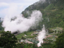
The Zombie Apocalypse is becoming an increasingly popular pop-culture reference as well as a well-timed allusion to an unsure world. Everything from popular memes to elaborate survival guides harken to the unlikely, but nevertheless terrifying, presupposition that an unknown virus will infect the world's population turning the recently deceased into flesh-hungry undead, endlessly pursuing the living. As Max Brooks, the author of The Zombie Survival Guide suggest, the undead themselves act in a viral nature: they are self-replicating, relentless, and unemotional and that is what makes the threat of a zombie apocalypse so terrifying. They exponentially replicate, they never stop, and there is no way to reason with them... you can only run, and run you will! But where to? 

We all have seen enough of the zombie genre films to know that there are very few hiding places that the ravenous undead will not eventually get us. The unsuspecting subjects of Romero's Night of the Living Dead retreated to a farmhouse and in Dawn of the Dead a shopping mall. Both proving no good in the long run, though the mall is probably your best bet for a while. The brain munching zombies from Return of the Living Dead trapped their quarry in an active funeral home and that was an epic fail for those unfortunate victims. Or, in more recent memory, the heroic gang of AMC's The Walking Dead has holed up in an abandoned prison with various ups and downs that go to show there really is no totally safe refuge. 

This brings us to yet another underlying, albeit psychological, effect of being a survivor of the zombie apocalypse: The built world, and particularly our homes, retail stores, municipal building, and even places of worship, are all equally susceptible to the surging hordes of flesh-eaters just outside. It presupposes that our most intimate spaces, the personal spaces that we retreat to and the social spaces we venture to, the ones that make us feel human and free and safe, no longer offer the same mental and physical solace. In fact, they become just the opposite: a prison where the only option is a horrible death at the hands of cannibalistic ghouls, crazed humans, potential dehydration and starvation, or even ourselves. The thought of being trapped in the buildings that serve us in our normal lives, the structures that are created by us and for us and our quality of life, is quite unsettling and it turns the security and civility of Architecture on itself where our homes and stores, our churches and courthouses become our hiding places, prisons, and, inevitably, our crypts.


If you would like to read more on how to fortify your domicile against the zombie hordes check out this link!

If you are in the market for a new home and want it to be zombie proof check out this link!

And if the musings here are not enough mental stimuli and you want to read Sam Jacob's argument against the concept of "zombie architecture" and the often misplaced nostalgia of resurrecting historic buildings, check out this link!


Happy Halloween from Urban Times!!!


Steven Holl Architects wins Qingdao Culture and Art Center competition in China

Steven Holl Architects has been chosen to design the Qingdao City Culture and Art Center after a unanimous jury decision. 

Other big-name contenders for the winning spot included OMA and Zaha Hadid Architects.


As part of an extension project in Qingdao, the new design will be 2 million sq. feet consisting of four art museums located in the heart of the city.


Below are more details on Steven Holl Architects' latest win.


Steven Holl Architects' winning design for the new Qingdao Culture and Art Center. Image: Steven Holl Architects.
Steven Holl Architects' winning design for the new Qingdao Culture and Art Center. 

From the Steven Holl Architects press statement:

"The winning design for the new Culture and Art Center begins with a connection to Qingdao. The linear form of the Jiaozhou Bay Bridge—the world’s longest bridge over water—is carried into the large site, in the form of a Light Loop, which contains gallery spaces and connects all aspects of the landscape and public spaces. The raised Light Loop allows maximum porosity and movement across the site, and permits natural sound bound breezes that blow in off the ocean to flow across the site."


North view. Image: Steven Holl Architects.
North view. 

"Set within the master plan are Art Islands, or Yishudao, which take the form of three sculpted cubes, and four small landscape art islands that form outdoor sculpture gardens. Five terraced reflecting pools animate the landscape and bring light to levels below via skylights."

Drawing: Fusion of landscape and architecture. Image: Steven Holl Architects.
Drawing: Fusion of landscape and architecture. 

Revised Drawing of Yishudao/Art Islands and Light Loop. Image: Steven Holl Architects.
Revised Drawing of Yishudao/Art Islands and Light Loop. 

"The Light Loop and Yishudao concepts facilitate the shaping of public space. A great central square for large gatherings is at the center of the site overlooking a large water garden. The Modern Art Museum shapes the central square. The Public Arts Museum forms the main experience of entry from the south. The North Yishudao contains the Classic Art Museum, with a hotel at its top levels, and the South Yishudao, which floats over the large south reflecting pool, holds the Performing Arts Program."

Drawing of one of the Yishudao/Art Islands. Image: Steven Holl Architects.
Drawing of one of the Yishudao/Art Islands. 

Drawing: Yishudao South Entry Plaza. Image: Steven Holl Architects.
Drawing: Yishudao South Entry Plaza.

"In the Light Loop, all horizontal galleries receive natural light from the roof that can be controlled with 20% screens as well as blackout options. The 20 meter wide section of the Light Loop allows side lighting to the lower level galleries, and provides space for two galleries side by side, avoiding dead-end circulation."

East Cube. Image: Steven Holl Architects.
East Cube. 

"The basic architecture is in simple monochrome of sanded marine aluminum and stained concrete, with the undersides of the Light Loops in rich polychrome colors of ancient Chinese architecture. These soffits are washed with light at night to become landscape lighting in shimmering reflected colors."

Cafe. Image: Steven Holl Architects.
Cafe. 

"The basic architecture is in simple monochrome of sanded marine aluminum and stained concrete, with the undersides of the Light Loops in rich polychrome colors of ancient Chinese architecture. These soffits are washed with light at night to become landscape lighting in shimmering reflected colors."

South Cube. Image: Steven Holl Architects.
South Cube.

"The entire project uses the most sustainable green technologies. Placed between the skylights on the Light Loop, photovoltaic cells will provide 80% of the museum’s electrical needs. The reflecting ponds with recycle water, while 480 geothermal wells provide heating and cooling."

Night view. Image: Steven Holl Architects.
Night view. 

Watch the competition video here.
And for more info, click here.
Be sure to click the thumbnails to see additional images.

Images courtesy of Steven Holl Architects.

Wednesday, October 30, 2013

The Era of “When, Not If,” Compels a New Approach to Waterfront Development


On the anniversary of Hurricane Sandy, ULI offers guidance on post-disaster rebuilding and building in anticipation of future disasters in a way that helps preserve the environment, boost economic prosperity, and foster a high quality of life.
Master Sgt. Mark C. Olsen / Wikimedia Commons
Patrick Phillips, CEO of the Urban Land InstituteWith the one-year anniversary of Hurricane Sandy upon us, the storm’s impact is still evident in many of the Northeast’s coastal communities, and there are plenty of unanswered questions and unresolved issues about where and what to rebuild. One thing is certain: Sandy was not a freak occurrence. While stunning in the scope of its destruction, it was but one of an increasing number of severe weather-related events that are affecting urban areas around the globe. 
We’ve entered the era of when, not if, in terms of future storms; that is the reality of climate change. Going forward, the impact of climate change, particularly rising sea levels, will factor into virtually every aspect of redevelopment and development, with as much emphasis being placed on strengthening community resilience as on boosting economic prosperity and fostering a high quality of life. For many areas, this will mean adopting a new approach to waterfront development.
This past July, the Urban Land Institute convened an interdisciplinary panel of 23 land use and urban planning experts to explore adaptation of the built environment to climate change; the areas hit hardest by Sandy served as the backdrop for their work. The panelists spent a week touring affected neighborhoods in New York and New Jersey, interviewing public officials and other community stakeholders, and reviewing local and federal plans for rebuilding. Their conclusions formed the basis for a new report, After Sandy[PDF], which offers guidance on how to protect coastal properties and natural resources, and provide increased value to individual property owners and communities at large.
One of the main takeaways: bringing back a storm-ravaged community does not necessarily mean re-creating the past. Rather than a redo, rebuilding should be viewed as an opportunity to do better. This is based on the panelists’ consensus that, given the impacts of climate change, it would be irresponsible,   dangerous, and possibly deadly to rebuild in vulnerable areas.
The rebuilding recommendations included specifics on land use, insurance, infrastructure and targeting investments, all aimed at encouraging businesses and residents to locate and rebuild in less risky areas, helping to ensure the safety and sustainability of the entire community.  As one panelist said, “Let’s build it (the region hit by Sandy) back not the way it was, but the way it will survive.”
Among the key recommendations:
Jurisdictions should identify local land use typologies to realistically and accurately assess a region’s capacity for resiliency. This would include a thorough evaluation of environmental conditions, considered along with political, cultural, economic and demographic factors, as well as population density and access to transit. Each typology would be analyzed on a rebuilding cost/benefit basis, with top priority for development given to the least risky areas.
Establish new categories of coastal land use and infrastructure zones to create new frameworks for public and private investment decisions. The panel suggested four new zones:
  • Coastal Transition Zones - The riskiest areas where public subsidies and investments would be substantially reduced or eliminated, and where public buyout funds would be created to allow private landowners the opportunity to sell property to the public at fair-market value.
  • Coastal Impact Zones - Areas where public investment in infrastructure would be structured to accommodate failure with limited impact during storms and flooding, and which would not receive further public support following flooding.
  • Coastal Transformation Zones - Where public subsidies and investments would be targeted to transform the built environment from a high-risk design to one that is much more resilient, incorporating, for instance, natural barriers with manmade ones.
  • Smart Growth Receiving Zones - The lowest-risk areas that could be designated as preferred areas for development, and for which investment could be structured to encourage the relocation of businesses and residents in a way that minimizes market disruption.
Design protective infrastructure to do more than protect. Protective infrastructure can be of significant economic and ecological value if designed in a way that contributes to the creation of new development opportunities, doubles up to accommodate other infrastructure uses, improves the quality of the public realm, and enhances natural systems. 
Accurately price climate risk into property value and flood insurance.Climate risk is a relatively new challenge for the insurance industry, and thorough analysis is needed to make sure that pricing is commensurate with risk. Insurance pricing should be analyzed to determine whether market distortions are occurring due to misunderstandings of climatic events.
Allow partial compliance and mitigation measures to create flexibility in insurance premiums. Premiums reductions should consider all mitigation efforts taken to counter the impact of storm damage, such as elevating mechanical systems. In addition, an assessment of the value of mitigation efforts should encourage investments in protective retrofits.
Devolve funding to the lowest effective level of government. Villages, townships and cities should have the authority to manage and implement federal and state funds, provided they can prove the capacity to do so, and that decisions are coordinated regionally.
And, the recommendation perhaps most necessary to ensure progress on community resiliency: Reconstitute the Hurricane Sandy Task Force. There is a clear need for a permanent entity comprised of federal, state and local representatives to keep the rebuilding process coordinated. The task force dedicated to the areas hit by Sandy could serve as a replicable model for other areas.       
Each of these observations reflects the hard lesson learned from Sandy that is applicable to any vulnerable area: What used to work for waterfront development simply will not work in a world forever affected by climate change. It’s time to rethink what, where, how and why we are building, with the end game being communities that are safer, more livable, and, as a result, more vibrant and prosperous.

Patrick L. Phillips is the Chief Executive Officer of the Urban Land Institute (ULI)

Towards a Resource Centric Design

U.S. Population per square mile
In the current economic circumstances, planners and designers are charged with the difficult task of doing more with less. By not preventing the same mistakes and misconceptions made by the Modernist movement of the second quarter of the 20th century, the design community has, over the past couple of decades, reduced planning and design to a formulaic and often homogeneous approach in the urban and suburban fabric. Their method: create a standardized design process that results in a standardized appearance and function that ultimately relates to a uniform and familiar significance. Objects and landscapes are normalized via the propagation of a secure perspective. The environment is something to be consumed.

We, as a nation, are privileged to have a large, mostly temperate land mass; a diverse and relatively small population base; and a rich and plentiful resource base. However, our inability to address the implementation of an integrated design ethic at the regional level, has, in large part, contributed to planning and design that does not address energy conservation and resource consumption at the macro level. Sustainability is mere language, if there is no large-scale view, in real-time, of the energy flows that drive all of earth's systems. Resource modeling at the regional scale is paramount to understanding how basic, yet diverse, concepts like carrying capacity, soil stability and traffic volumes relate to events and objects at the end-user level: healthy communities, sound construction and thoughtful resource conservation.


The resulting concept is a region-specific system of detailed design decisions that are rooted in a firm understanding of the natural processes that support all living things, as well as the artificial processes that mediate the natural environment for human use. The following images attempt to illustrate a simple environmental motive: water and petroleum conservation as related to the decentralization of conventional agriculture in favor of a localized food system.


The colors range on the maps are normalized to be relative to each other and the color scale is simple: The darkest red means high and the darkest green means low with the scale of colors in between indicating the full range respectively. 


Total farmland as a percentage of total land
Acres of corn harvested
Kilograms of the agrochemical Atrazine applied per acre
Percentage of farms owned by a family or individual
Mean precipitation
This series of maps illustrates a simple spatial concept that relates to a multitude of complex implementation strategies. The goal of this particular example of a Resource Centric Design strategy is the decentralization of conventional agriculture in favor of sustainable, or even surpassable, local food systems. In essence the maps here, produced from various but respected data sources, speak to the inefficient resource consumption and potential chemical abuses of an Industrial Agricultural System and its dependence on fossil fuels and unsustainable water management practices. This single perspective of a much more complex problem could, in part, lead to the formulation of an integrated design ethic that could holistically protect sensitive watersheds, activate local economies and reduce petroleum consumption significantly when applied at the regional level.

For some recent news on the agrochemical Atrazine Click Here!

Source: USDA, ESRI, US Census

Posted By William Aultman@ EcoUrbanity

Tuesday, October 29, 2013

Urban Water Cycle: The Urban Infleuence on our Most Valuable Resource

Graphic courtesy of The City of Auckland

One of the most environmentally damaging aspects of urban life is the high percentage of impervious surfaces in and around most metropolitan regions. These conditions (as seen in the nice graphic above) reduce aquifer recharge and contribute to reduced stream flow or, in the case of heavy rains, flooding. The world's fresh water reserves are at an all time low and rapid development coupled with poor water management practices are creating what will become a global water crisis. The price of one barrel(US, petroleum) of oil is floating somewhere around $100.00, whereas the average price of one barrel(US, petroleum) of water is somewhere around $0.25. Wow...! What a bargain considering humans cannot live for much more than a few days without water, but we certainly do not need petroleum to be able to biologically function. I wonder what will happen when tap water is as expensive as oil? Bottled water already is...

For some insight on an urban area trying to address this issue...

For some interesting facts on the price of water in the US...

Post submitted by William Aultman@ EcoUrbanity

Friday, October 25, 2013

MoMA’s “Uneven Growth: Tactical Urbanisms for Expanding Megacities” to launch Oct. 26

MoMA will launch the first workshop for "Uneven Growth: Tactical Urbanisms for Expanding Megacities" starting Saturday, Oct. 26 at MoMA PS1 in New York City.

In this workshop series, six interdisciplinary teams will propose innovative ways of how to perceive urban growth as a response to the disproportionate expansion and its potential consequences in six of the world's metropolises. The workshops will also open these pressing issues to public discussion.

The proposals will then be exhibited at the MoMA PS1 in November 2014, the second phase of the Uneven Growth initiative.


Morro do Alemão, Rio de Janeiro, 2012. Photograph by Pedro Rivera, RUA Arquitetos.

From the MoMA press release:

"The Museum of Modern Art announces a 14-month initiative to examine new architectural possibilities that address the rapid and uneven growth of six global metropolises: New York, Rio de Janeiro, Mumbai, Lagos, Hong Kong, and Istanbul. Organized by Pedro Gadanho, Curator, Department of Architecture and Design, Uneven Growth: Tactical Urbanisms for Expanding Megacities enlists six interdisciplinary teams of international architecture and urbanism scholars, experts, and practitioners to participate in a series of workshops that begin on October 26, 2013, with each team focusing on a specific city. The resulting proposals will be exhibited at MoMA from November 22, 2014, to May 10, 2015.Uneven Growth is organized by MoMA in collaboration with the Museum of Applied Arts (MAK), Vienna.

'In 2030, the world’s population will be a staggering eight billion people. Of these, two-thirds will live in cities, and most will be poor and with limited resources. This unbalanced growth will be one of the greatest challenges to societies across the globe,' said Mr. Gadanho. 'City authorities, urban planners and designers, and economists will need to join forces in an attempt to avoid a major social and economical catastrophe, working together to ensure that expanding megacities will be habitable. Uneven Growth will enable MoMA to take a leadership role in addressing this challenge.'

For the workshop phase of Uneven Growth, teams are challenged to create proposals that offer new and inventive ways of thinking about the growth of cities. The design teams develop projects under the curatorial and critical guidance of MoMA’s Department of Architecture and Design, and an advisory board that includes such leading figures as Saskia Sassen, David Harvey, Ricky Burdette, Neil Brenner, Nader Tehrani, Michael Sorkin, Marc Angélil, Teddy Cruz, and others.

The workshop phase launches on Saturday, October 26, 2013. Following an initial workshop in the VW Dome at MoMA PS1, workshops are also planned at The Value Factory in Shenzhen, China, in December 2013, and at MAK, in Vienna in June 2014. These events will produce responses to the theme, while bringing the larger discussion to the general public. For the second phase of Uneven Growth, MoMA will present an exhibition of the resulting proposals, beginning on November 22, 2014. At the center of the exhibition will be design visions for the near future of the selected cities, comprising drawings, renderings, films and animations to be produced by the six teams during the workshop period. The final result will be an exhibition catalogue that brings together each of the proposals and groundbreaking essays about the subject..."

Thursday, October 24, 2013

Global ecosystems ‘face collapse’


from BBC World News Service

Current global consumption levels could result in a large-scale ecosystem collapse by the middle of the century, environmental group WWF has warned.

The group’s biannual Living Planet Report said the natural world was being degraded “at a rate unprecedented in human history”. Terrestrial species had declined by 31% between 1970-2003, the findings showed. It warned that if demand continued at the current rate, two planets would be needed to meet global demand by 2050. The biodiversity loss was a result of resources being consumed faster than the planet could replace them, the authors said. They added that if the world’s population shared the UK’s lifestyle, three planets would be needed to support their needs.


The nations that were shown to have the largest “ecological footprints” were the United Arab Emirates, the United States and Finland. Paul King, WWF director of campaigns, said the world was running up a “serious ecological debt”. “It is time to make some vital choices to enable people to enjoy a one planet lifestyle,” he said. “The cities, power plants and homes we build today will either lock society into damaging over-consumption beyond our lifetimes, or begin to propel this and future generations towards sustainable one planet living.”


The report, compiled by the Zoological Society of London (ZSL) and the Global Footprint Network, is based on data from two indicators:


· Living Planet Index - assesses the health of the planet’s ecosystems


· Ecological Footprint - measures human demand on the natural world


The Living Planet Index tracked the population of 1,313 vertebrate species of fish, amphibians, reptiles, birds and mammals from around the world. It found that these species had declined by about 30% since 1970, suggesting that natural ecosystems were being degraded at an unprecedented rate. The Ecological Footprint measured the amount of biologically productive land and water to meet the demand for food, timber, shelter, and absorb the pollution from human activity. The report concluded that the global footprint exceeded the earth’s biocapacity by 25% in 2003, which meant that the Earth could no longer keep up with the demands being placed upon it. The findings echo a study published earlier this month that said the world went into “ecological debt” in October of 2006. The study by UK-based think-tank New Economics Foundation (NEF) was based on the Ecological Footprint data compiled by the Global Footprint Network, which also provided the figures for this latest report from the WWF.


‘Large-scale collapse’


One of the report’s editors, Jonathan Loh from the Zoological Society of London, said: “[It] is a stark indication of the rapid and ongoing loss of biodiversity worldwide. “Populations of species in terrestrial, marine and freshwater ecosystems have declined by more than 30% since 1970,” he added. “In the tropics the declines are even more dramatic, as natural resources are being intensively exploited for human use.” The report outlined five scenarios based on the data from the two indicators, ranging from “business as usual” to “transition to a sustainable society”.


Under the “business as usual” scenario, the authors projected that to meet the demand for resources in 2050 would be twice as much as what the Earth could provide. They warned: “At this level of ecological deficit, exhaustion of ecological assets and large-scale ecosystem collapse become increasingly likely.”


To deliver a shift towards a “sustainable society” scenario would require “significant action now” on issues such as energy generation, transport and housing.

Alternative Energy for Sustaining Human Life

Winston Churchill once said that Americans will always do the right thing... as a last resort! Though that may be a bit pessimistic, sadly, there is probably some logic to that statement. An environmental metaphor that one might draw from Mr. Churchill's quip is one of resources and consumption, or, supply and demand, if you like economics. The massive urban developments in the middle and far east have out-scaled anything westernized nations have attempted, and they are making some advancements in methods to sustainably create and maintain these new urban areas. However, the lifestyles of the westernized societies that these countries emulate, even if just partially, are not responding fast enough to the unfortunate reality of the world's dwindling resource availability. The scale of development worldwide, coupled with a continuous dependency on fossil fuels, poses an interesting problem that there is no clear, single answer to. How does the world allow economic development and cultural potential while at the same time restricting the over consumption of remaining resources? A possible partial solution (in addition to first world countries drastically reducing consumption) may be a renewable energy superstructure for rapidly urbanized areas. It would comprise of a matrix of renewable energy facilities geographically placed for maximum production and minimum impact. Any of the individual modes of production could in no way support the entire area, but, as a part of a larger superstructure, the pieces form a comprehensive "Energy Web" that does not completely rely on any single form of production.

Geothermal energy is provocative and seemingly endless, even without imagining drilling into the center of the earth. Its applications, though difficult to harness in some cases, are consistently proving to offer reliable means to collect or generate energy. From constant ground temperature to volcanic steam vents the fact that the majority of the earths mass is a molten core of rock and metal is hard to ignore.


With increased technology and awareness, wind generated electricity is rapidly becoming a much more viable means to power our lives. The use of a meteorological phenomena to generate motion or electricity is not a new idea, but with current advancements in design and policy based initiatives wind power will play a huge factor in the global energy market.

The sun is responsible for the existence of all life on Earth. All of the planet's growing systems assimilate everything from a small star at the heart of our solar system. Unfortunately solar technology has been slow to develop into a widespread energy harvesting method for reasons that range from the expense of solar panels to the suppression of solar advocacy and technology by conventional energy lobbyist.


Hydroelectric energy production has, like wind power, been around for a long time. However, the large scale installation of dams worldwide have proven to be one of the most disruptive and damaging of human efforts to terrestrial ecosystems. But like free flowing rivers, the undulations of the worlds oceans have untapped and practically endless applications for free energy production. This could be applied on a large scale in most coastal areas and even within sensitive habitat.


Through the quest for self importance and universal convenience, the resources that were once so plentiful just a century or two ago are now scarce commodities. It seems now, just as the early Buddhist used the four great elements to explain and understand their earthly suffering, modern humans have reinterpreted their perspectives of earth, air, fire and water in efforts to gain ground in the global scramble for survival.

Post submitted by W. A. Aultman / WilliamAultman@EcoUrbanity